Friday, May 13, 2011

Deepest Sea : Caribbean Sea


The Caribbean Sea is a sea of the Atlantic Ocean situated in the tropics of the Western hemisphere. It is bounded by Mexico and Central America to the west and southwest, to the north by the Greater Antilles, and to the east by the Lesser Antilles.
The entire area of the Caribbean Sea, the numerous islands of the West Indies, and adjacent coasts, are collectively known as the Caribbean. The Caribbean Sea is one of the largest salt water seas and has an area of about 2,754,000 km² (1,063,000 sq. mi.). The sea's deepest point is the Cayman Trough, between the Cayman Islands and Jamaica, at 7,686 m (25,220 ft) below sea level. The Caribbean coastline has many gulfs and bays: the Gulf of GonâveGulf of VenezuelaGulf of Darién,Golfo de los MosquitosGulf of Paria and Gulf of Honduras.
The name "Caribbean" is derived from the Caribs, one of the dominant American Indian groups in the region at the time of European contact during the late 15th century. After the discovery of the West Indies by Christopher Columbus in 1492, the Spanish term Antillas was assigned to the lands; stemming from this, "Sea of the Antilles" is a common alternative name for the Caribbean Sea in various European languages. During the first century of development, the Spanish dominance was undisputed.

Thursday, May 12, 2011

Deepest Ocean: Indian Ocean


The Indian Ocean is the third largest of the world's oceanic divisions, covering approximately 20% of the water on the Earth's surface. It is bounded on the north by the Indian subcontinent; on the west by East Africa; on the east by Indochina, the Sunda Islands, and Australia; and on the south by the Southern Ocean (or, depending on definition, by Antarctica). The ocean is named after the geographic location called India.
As one component of the interconnected global ocean, the Indian Ocean is delineated from the Atlantic Ocean by the 20° east meridian running south from Cape Agulhas, and from the Pacific by the meridian of 146°55' east.The northernmost extent of the Indian Ocean is approximately 30° north in the Persian Gulf. The Indian Ocean has asymmetric ocean circulation[citation needed]. This ocean is nearly 10,000 kilometres (6,200 mi) wide at the southern tips of Africa and Australia; its area is 73,556,000 square kilometres (28,350,000 sq mi), including the Red Sea and the Persian Gulf.
The ocean's volume is estimated to be 292,131,000 cubic kilometres (70,086,000 mi3).Small islands dot the continental rims. Island nations within the ocean are Madagascar, the world's fourth largest island; Reunion Island;Comoros; Seychelles; Maldives; Mauritius; and Sri Lanka. The archipelago of Indonesia borders the ocean on the east.

Wednesday, May 11, 2011

Sea: Andaman Sea


The Andaman Sea or Burma Sea is a body of water to the southeast of the Bay of Bengal, south of Burma, west of Thailand and east of the Andaman Islands, India; it is part of the Indian Ocean.
The sea has been traditionally used for fishery and transportation of goods between the coastal countries and its coral reefs and islands are popular tourist destinations. The fishery and tourist infrastructure has been severely damaged by the 2004 Indian Ocean earthquake and tsunami.
The average depth of the sea is about 1,000 meters (3,300 ft). The northern and eastern parts are shallower than 180 meters (600 ft) due to the silt deposited by the Irrawaddy River. This major river flows into the sea from the north through Burma. The western and central areas are 900–3,000 meters deep (3,000–10,000 ft). Less than 5% of the sea is deeper than 3,000 meters (10,000 ft), and in a system of submarine valleys east of the Andaman-Nicobar Ridge, the depth exceeds 4,000 meters (13,200 ft). The sea floor is covered with pebbles, gravel and sand.


Tuesday, May 10, 2011

Ocean: Atlantic Ocean


The Atlantic Ocean is the second largest of the world's five oceans (after the Pacific Ocean, but larger than the Indian Ocean, Southern Ocean, and Arctic Ocean). The Kiel Canal (Germany), Oresund (Denmark-Sweden), Bosporus (Turkey), Strait of Gibraltar (Morocco-Spain), and the Saint Lawrence Seaway (Canada-US) are important strategic access waterways. The decision by the International Hydrographic Organization in the spring of 2000 to delimit a fifth world ocean, the Southern Ocean, removed the portion of the Atlantic Ocean south of 60 degrees south latitude.

The Atlantic Ocean is essentially an S-shaped north-south channel, extending from the Arctic Ocean in the north to the Antarctic continent in the south and situated between the eastern coast of the American continents and the western coasts of Europe and Africa. The Atlantic Ocean proper has a surface area of about 82 million sq km (about 31,660,000 sq mi). Including its marginal seas-the Gulf of Mexico-Caribbean Sea, the Arctic Ocean, and the North, Baltic, Mediterranean, and Black seas-the total area is about 106,190,000 sq km (about 41 million sq mi). 


Monday, May 9, 2011

Longest Coastline: Canada

Canada (play /ˈkænədə/) is a North American country consisting of ten provinces and three territories. Located in the northern part of the continent, it extends from the Atlantic Ocean in the east to the Pacific Ocean in the west and northward into the Arctic Ocean. It is the world's second largest country by total area. Canada's common border with the United States to the south and northwest is the longest in the world.


The land that is now Canada was inhabited for millennia by various groups of Aboriginal peoples. Beginning in the late 15th century, British and French expeditions explored, and later settled, along the Atlantic coast. France ceded nearly all of its colonies in North America in 1763 after the Seven Years' War. In 1867, with the union of three British North American colonies through Confederation, Canada was formed as a federaldominion of four provinces. This began an accretion of provinces and territories and a process of increasing autonomy from the United Kingdom. This widening autonomy was highlighted by the Statute of Westminster 1931 and culminated in the Canada Act 1982, which severed the vestiges of legal dependence on the British parliament.


Canada is a federal state that is governed as aparliamentary democracy and a constitutional monarchy with Queen Elizabeth II as its head of state. It is a bilingual nation with both English and French as official languages at the federal level. One of the world's highly developed countries, Canada has a diversified economy that is reliant upon its abundant natural resources and upon trade—particularly with the United States, with which Canada has had a long and complex relationship.


The coastline of Canada, including all its islands, is more than six times as long as the distance round the Earth at the Equator [40,076km]. Greenland is not in this list as it is part of Denmark, not a separate country, but its coastline measures 44,087km.


Source:http://en.wikipedia.org/wiki/Canada

Longest Glacier: Lambert Fisher

Fisher Glacier is a prominent western tributary to the Lambert Glacier, about 100 miles (160 km) long, flowing east past the north sides of Mount Menzies and Mount Rubin and joining the main stream of the Lambert Glacier just east of Mount Stinear. Sighted from ANARE (Australian National Antarctic Research Expeditions) aircraft by K.B. Mather in 1957. 


During the last Ice Age, more than 30 percent of the Earth's surface was covered by glaciers- frozen rivers of ice that move very slowly. Even today, as much as 10 percent is covered with glaciers. The Lambert Fisher Glacier is the longest in the world and was only discovered in 1956. The longest glacier in North America is the Hubbard Glacier, Alaska, which measures 146km. The longest in Europe is the Aletsch Glacier, Switzerland, at 35km.


Source:http://en.wikipedia.org/wiki/Fisher_Glacier

Sunday, May 8, 2011

The Great Lake : Superior

Lake Superior  is the largest of the five Great Lakes of North America. It is bounded to the north by the Canadian province of Ontario and the U.S. state of Minnesota, and to the south by the U.S. states of Wisconsin and Michigan. It is the largest freshwater lakein the world by surface area if Lake Michigan-Huron is counted as two lakes and is the world's third-largest freshwater lake by volume.


The Ojibwe call the lake Gichigami, meaning "big water." Henry Wadsworth Longfellow wrote the name as "Gitche Gumee" in The Song of Hiawatha, as did Gordon Lightfoot in his song, "The Wreck of the Edmund Fitzgerald". "The first French explorers approaching the great inland sea by way of the Ottawa River and Lake Huron during the 17th century referred to their discovery as le lac superieur. Properly translated, the expression means "Upper Lake," that is, the lake above Lake Huron. The lake was also called Lac Tracy by 17th century Jesuit missionaries." The English, upon taking control of the region from the French in the 1760's, following the French and Indian War, anglicized the lake's name to Superior, "on account of its being superior in magnitude to any of the lakes on that vast continent."

Source:http://en.wikipedia.org/wiki/Lake_Superior

Saturday, May 7, 2011

Highest Water Fall: Angel


Angel Falls or Paradise Falls is a waterfall in Venezuela.
It is the world's highest waterfall, with a height of 979 m (3,212 ft) and a plunge of 807 m (2,648 ft). The waterfall drops over the edge of the Auyantepui mountain in the Canaima National Park, a UNESCO World Heritage site in the Gran Sabana region of Bolívar StateVenezuela.
The height of the fall is so great that, before getting anywhere near the ground, much of the water is evaporated or carried away as a fine mist by the strong wind.The base of the falls feeds into the Kerep River (alternatively known as the Río Gauya), which flows into the Churun River, a tributary of the Carrao River.
The height figure 979 m (3,212 ft) mostly consists of the main plunge but also includes about 400 m (0.25 mi) of sloped cascades and rapids below the drop and a 30 m (98 ft) high plunge downstream of the talus rapids. While the main plunge is undoubtedly the highest single drop in the world, some feel that including the lower cascades somewhat stretches the criteria for the measurement of waterfalls, although there are no universally recognized standards of waterfall measurement.
Source:

Friday, May 6, 2011

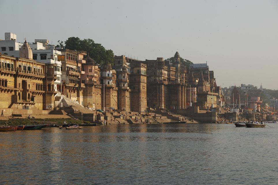
Greatest River:Ganges

The Ganges  or Ganga, is a trans-boundary river of India and Bangladesh. The 2,525 km (1,569 mi) river rises in the western Himalayas in the Indian state of Uttarakhand, and flows south and east through the Gangetic Plain of North India into Bangladesh, where it empties into the Bay of Bengal. By discharge it ranks among the world's top 20 rivers. The Ganges basin is the most heavily populated river basin in the world, with over 400 million people and a population density of about 1,000 inhabitants per square mile (390 /km2).
The Ganges is the most sacred river to Hindus and is also a lifeline to millions of Indians who live along its course and depend on it for their daily needs. It is worshiped as the goddess Ganga in Hinduism. It has also been important historically: many former provincial or imperial capitals have been located on its banks.

Source:http://en.wikipedia.org/wiki/Ganges

Thursday, May 5, 2011

Greatest Water Falls: Boyoma {Stanley}

Boyoma Falls, formerly known as Stanley Falls, consists of seven cataracts, each no more than 15' high, extending over more than 100 km (60 miles) along a curve of theLualaba River between the river port towns of Ubundu and Kisangani/Boyoma in theOrientale region of the Democratic Republic of the Congo.

The flow of many waterfalls varies according to the season, and some have been reduced by building dams to harness their power for hydroelectric plants. The flow of the Boyoma waterfall is equivalent to 17 million litres a second-enough to fill more than 140,000 baths per second ,or enough for every person on Earth to have two baths a day!


At the bottom of the rapids, the Lualaba becomes the Congo River. The seven cataracts have a total drop of 61 meters (200 feet). The two major cataracts are the first below Ubundu, forming a narrow and crooked stream that is hardly accessible, and the last that can easily be seen and also be visited from Kisangani.
A 1000mm portage railway bypasses the series of rapids, connecting Kisangani and Ubundu.


Wednesday, May 4, 2011

Longest River: Nile

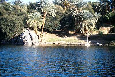
The Nile  is a major north-flowing river in North Africa, generally regarded as the longest river in the world. It is 6,650 km (4,130 miles) long.
The Nile has two major tributaries, the White Nile and Blue Nile. The latter is the source of most of the water and fertile soil. The former is the longer. The White Nile rises in theGreat Lakes region of central Africa, with the most distant source being as-yet undetermined, and located in either Rwanda or Burundi. It flows north through Tanzania,Lake VictoriaUganda and southern Sudan. The Blue Nile starts at Lake Tana inEthiopia  and flows into Sudan from the southeast. The two rivers meet near the Sudanese capital of Khartoum.

The northern section of the river flows almost entirely through desert, from Sudan intoEgypt, a country whose civilization has depended on the river since ancient times. Most of the population and cities of Egypt lie along those parts of the Nile valley north of Aswan, and nearly all the cultural and historical sites of Ancient Egypt are found along riverbanks. The Nile ends in a large delta that empties into the Mediterranean Sea.

Source:http://en.wikipedia.org/wiki/Nile

Lowest Place : Dead Sea

The Dead Sea (Arabicالبحر الميت‎ About this sound al-Bahr al-Mayyit ,[3] Hebrewיָם הַ‏‏מֶּ‏‏לַ‏ח‎‎, Yām Ha-Melaḥ, "Sea of Salt"), also called the Salt Sea, is a salt lake bordering Jordan to the east andIsrael and the West Bank to the west. Its surface and shores are 423 metres (1,388 ft) belowsea level,[2] the lowest elevation on the Earth's surface on dry land. The Dead Sea is 377 m (1,237 ft) deep, the deepest hypersaline lake in the world. With 33.7% salinity, it is also one of the world's saltiest bodies of water, though Lake Assal (Djibouti)Garabogazköl and some hypersaline lakes of the McMurdo Dry Valleys in Antarctica (such as Don Juan Pond) have reported higher salinities. It is 8.6 times saltier than the ocean.[4] This salinity makes for a harsh environment in which animals cannot flourish, hence its name. The Dead Sea is 67 kilometres (42 mi) long and 18 kilometres (11 mi) wide at its widest point. It lies in theJordan Rift Valley, and its main tributary is the Jordan River.

The Dead Sea has attracted visitors from around the Mediterranean basin for thousands of years. Biblically, it was a place of refuge for King David. It was one of the world's first health resorts (for Herod the Great), and it has been the supplier of a wide variety of products, from balms for Egyptian mummification to potash for fertilizers. People also use the salt and the minerals from the Dead Sea to create cosmetics and herbal sachets. In 2009, 1.2 million foreign tourists visited on the Israeli side.[citation needed]
The sea has a density of 1.24 kg/L, making swimming difficult but providing a relaxing floating experience.

Tuesday, May 3, 2011

Smallest Island In The World : Bishop Rock


The smallest island in the world is Bishop Rock, being it follows these specifications and requirements of being an island:
1. An island must be completely detatched from other lands, thus, it must be surrounded by water. Islands cannot be conjoined with other lands, as will qualify them for other land types.
2. An island MUST be inhabited, or formerly inhabited.

The smallest island in the world is Bishop Rock, 46 meters x 16 meters (736 square meters). The land pretrudes from the surface of the water around 4 feet (almost a meter), and has a lighthouse that is 44.2 meters high (approximately 144 feet). The lighthouse was originally intended to be 24 feet shorter (120 feet), but was washed away due to low reinforcement and island height. Bishop Rock is approximately 74/1000 hectares (1 hectare being 10,000 square meters), and is smaller than the Olympic Swimming pool, and a Rood, however, it is larger than a Chinese Mu and the Principality of Sealand (artificial island).

It serves as a border between the Atlantic Ocean and Great Britain. It is also at the westernmost tip of the Isle of Scilly. In 1901 a barque wrecked near Bishop Rock, drowing all her crew.


Source:http://wiki.answers.com/Q/What_is_the_smallest_island_in_the_world

Largest Island: Greenland [Kalaatdlit Nunaat]

Greenland (KalaallisutKalaallit Nunaat meaning "Land of the Greenlanders"; Danish:Grønland)[4] is an autonomous country within the Kingdom of Denmark, located between theArctic and Atlantic Oceans, east of the Canadian Arctic Archipelago. Though physiographicallya part of the continent of North America, Greenland has been politically associated with Europe(specifically Denmark–Norway) for about a millennium. The largest island in Greenland is also named Greenland, and makes up most of the country's land area.
Greenland has been inhabited, though not continuously, by indigenous peoples since 2500 BC. There were Norse colonies in Greenland from AD 986 until sometime most likely in the 15th century. In the early 18th century contact between Scandinavia and Greenland was re-established and Denmark established rule over Greenland.
Greenland is, by area, the world's largest island that is not a continent.[5] With a population of 56,452 (January 2010 estimate) it is one of the least densely populated dependencies or countries in the world.[6]

Source:http://en.wikipedia.org/wiki/Greenland

Sunday, May 1, 2011

Shortest Mountain: Ffynnon Garw {Garth Hill}

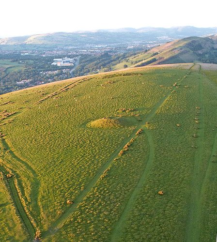
Garth Hill (usually called The Garth, or Garth MountainMynydd y Garth in Welsh) is a hill located near the village of Pentyrch in Cardiff. It is thought to be the inspiration for "Ffynnon Garw", the fictional mountain (or hill) featured in the book, and later, film, The Englishman Who Went Up a Hill But Came Down a Mountain by Christopher Monger.
The Garth can be seen near enough all over the Welsh capital city of Cardiff, and on a sunny, clear day as far as Weston-super-Mare across the Bristol Channel in the South West of England. It lies adjacent to the Taff Vale with the village of Pentyrch on one side and looks down onto the small village of Gwaelod-y-Garth. The Garth has a number oftumuli on its top [1]. These date from the early to middle Bronze Age, around 2000 BC. They are burial sites.
A book was written about "Ffynnon Garw" which was made into a film The Englishman Who Went Up a Hill But Came Down a Mountain (1995). The location of Ffynnon Garw rather implies it is The Garth; however, the story is fictional. The popular movie has resulted in a stream of visitors climbing to the summit of Garth Mountain to view the location.

Source:http://en.wikipedia.org/wiki/Garth_Hill