Thursday, May 5, 2011

Greatest Water Falls: Boyoma {Stanley}

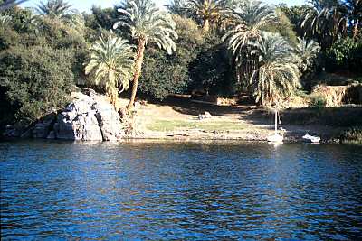
Boyoma Falls, formerly known as Stanley Falls, consists of seven cataracts, each no more than 15' high, extending over more than 100 km (60 miles) along a curve of theLualaba River between the river port towns of Ubundu and Kisangani/Boyoma in theOrientale region of the Democratic Republic of the Congo.

The flow of many waterfalls varies according to the season, and some have been reduced by building dams to harness their power for hydroelectric plants. The flow of the Boyoma waterfall is equivalent to 17 million litres a second-enough to fill more than 140,000 baths per second ,or enough for every person on Earth to have two baths a day!


At the bottom of the rapids, the Lualaba becomes the Congo River. The seven cataracts have a total drop of 61 meters (200 feet). The two major cataracts are the first below Ubundu, forming a narrow and crooked stream that is hardly accessible, and the last that can easily be seen and also be visited from Kisangani.
A 1000mm portage railway bypasses the series of rapids, connecting Kisangani and Ubundu.


Wednesday, May 4, 2011

Longest River: Nile

The Nile  is a major north-flowing river in North Africa, generally regarded as the longest river in the world. It is 6,650 km (4,130 miles) long.
The Nile has two major tributaries, the White Nile and Blue Nile. The latter is the source of most of the water and fertile soil. The former is the longer. The White Nile rises in theGreat Lakes region of central Africa, with the most distant source being as-yet undetermined, and located in either Rwanda or Burundi. It flows north through Tanzania,Lake VictoriaUganda and southern Sudan. The Blue Nile starts at Lake Tana inEthiopia  and flows into Sudan from the southeast. The two rivers meet near the Sudanese capital of Khartoum.

The northern section of the river flows almost entirely through desert, from Sudan intoEgypt, a country whose civilization has depended on the river since ancient times. Most of the population and cities of Egypt lie along those parts of the Nile valley north of Aswan, and nearly all the cultural and historical sites of Ancient Egypt are found along riverbanks. The Nile ends in a large delta that empties into the Mediterranean Sea.

Source:http://en.wikipedia.org/wiki/Nile

Lowest Place : Dead Sea

The Dead Sea (Arabicالبحر الميت‎ About this sound al-Bahr al-Mayyit ,[3] Hebrewיָם הַ‏‏מֶּ‏‏לַ‏ח‎‎, Yām Ha-Melaḥ, "Sea of Salt"), also called the Salt Sea, is a salt lake bordering Jordan to the east andIsrael and the West Bank to the west. Its surface and shores are 423 metres (1,388 ft) belowsea level,[2] the lowest elevation on the Earth's surface on dry land. The Dead Sea is 377 m (1,237 ft) deep, the deepest hypersaline lake in the world. With 33.7% salinity, it is also one of the world's saltiest bodies of water, though Lake Assal (Djibouti)Garabogazköl and some hypersaline lakes of the McMurdo Dry Valleys in Antarctica (such as Don Juan Pond) have reported higher salinities. It is 8.6 times saltier than the ocean.[4] This salinity makes for a harsh environment in which animals cannot flourish, hence its name. The Dead Sea is 67 kilometres (42 mi) long and 18 kilometres (11 mi) wide at its widest point. It lies in theJordan Rift Valley, and its main tributary is the Jordan River.

The Dead Sea has attracted visitors from around the Mediterranean basin for thousands of years. Biblically, it was a place of refuge for King David. It was one of the world's first health resorts (for Herod the Great), and it has been the supplier of a wide variety of products, from balms for Egyptian mummification to potash for fertilizers. People also use the salt and the minerals from the Dead Sea to create cosmetics and herbal sachets. In 2009, 1.2 million foreign tourists visited on the Israeli side.[citation needed]
The sea has a density of 1.24 kg/L, making swimming difficult but providing a relaxing floating experience.

Tuesday, May 3, 2011

Smallest Island In The World : Bishop Rock


The smallest island in the world is Bishop Rock, being it follows these specifications and requirements of being an island:
1. An island must be completely detatched from other lands, thus, it must be surrounded by water. Islands cannot be conjoined with other lands, as will qualify them for other land types.
2. An island MUST be inhabited, or formerly inhabited.

The smallest island in the world is Bishop Rock, 46 meters x 16 meters (736 square meters). The land pretrudes from the surface of the water around 4 feet (almost a meter), and has a lighthouse that is 44.2 meters high (approximately 144 feet). The lighthouse was originally intended to be 24 feet shorter (120 feet), but was washed away due to low reinforcement and island height. Bishop Rock is approximately 74/1000 hectares (1 hectare being 10,000 square meters), and is smaller than the Olympic Swimming pool, and a Rood, however, it is larger than a Chinese Mu and the Principality of Sealand (artificial island).

It serves as a border between the Atlantic Ocean and Great Britain. It is also at the westernmost tip of the Isle of Scilly. In 1901 a barque wrecked near Bishop Rock, drowing all her crew.


Source:http://wiki.answers.com/Q/What_is_the_smallest_island_in_the_world

Largest Island: Greenland [Kalaatdlit Nunaat]

Greenland (KalaallisutKalaallit Nunaat meaning "Land of the Greenlanders"; Danish:Grønland)[4] is an autonomous country within the Kingdom of Denmark, located between theArctic and Atlantic Oceans, east of the Canadian Arctic Archipelago. Though physiographicallya part of the continent of North America, Greenland has been politically associated with Europe(specifically Denmark–Norway) for about a millennium. The largest island in Greenland is also named Greenland, and makes up most of the country's land area.
Greenland has been inhabited, though not continuously, by indigenous peoples since 2500 BC. There were Norse colonies in Greenland from AD 986 until sometime most likely in the 15th century. In the early 18th century contact between Scandinavia and Greenland was re-established and Denmark established rule over Greenland.
Greenland is, by area, the world's largest island that is not a continent.[5] With a population of 56,452 (January 2010 estimate) it is one of the least densely populated dependencies or countries in the world.[6]

Source:http://en.wikipedia.org/wiki/Greenland

Sunday, May 1, 2011

Shortest Mountain: Ffynnon Garw {Garth Hill}

Garth Hill (usually called The Garth, or Garth MountainMynydd y Garth in Welsh) is a hill located near the village of Pentyrch in Cardiff. It is thought to be the inspiration for "Ffynnon Garw", the fictional mountain (or hill) featured in the book, and later, film, The Englishman Who Went Up a Hill But Came Down a Mountain by Christopher Monger.
The Garth can be seen near enough all over the Welsh capital city of Cardiff, and on a sunny, clear day as far as Weston-super-Mare across the Bristol Channel in the South West of England. It lies adjacent to the Taff Vale with the village of Pentyrch on one side and looks down onto the small village of Gwaelod-y-Garth. The Garth has a number oftumuli on its top [1]. These date from the early to middle Bronze Age, around 2000 BC. They are burial sites.
A book was written about "Ffynnon Garw" which was made into a film The Englishman Who Went Up a Hill But Came Down a Mountain (1995). The location of Ffynnon Garw rather implies it is The Garth; however, the story is fictional. The popular movie has resulted in a stream of visitors climbing to the summit of Garth Mountain to view the location.

Source:http://en.wikipedia.org/wiki/Garth_Hill

Highest Mountains In The World: Mount Everest


Mount Everest, also known as Mount Chomolungma or Sagarmatha, is the world'shighest mountain above the mean sea level at 8,848 metres (29,029 ft). It is located in the Himalayas on the Nepal (Sagarmatha Zone)-China (Tibet) border.
In 1856, the Great Trigonometric Survey of British India established the first published height of Everest, then known as Peak XV, at 29,002 ft (8,840 m). In 1865, Everest was given its official English name by the Royal Geographical Society upon recommendation of Andrew Waugh, the British Surveyor General of India at the time, who named it after his predecessor in the post, and former chief, Sir George Everest.[4] Chomolungma had been in common use by Tibetans for centuries, but Waugh was unable to propose an established local name because Nepal and Tibet were closed to foreigners.
The highest mountain in the world attracts many well-experienced mountaineers as well as novice climbers who are willing to pay substantial sums to professional mountain guides to complete a successful climb. The mountain, while not posing substantial technical climbing difficulty on the standard route (other eight-thousanders such as K2 orNanga Parbat are much more difficult), still has many inherent dangers such as altitude sickness, weather, and wind.
Source: